Dataset Identification:
- The MAFLA (Mississippi, Alabama, Florida) Study was funded by NOAA as part of the Outer Continental Shelf Program. Dr. L.J. Doyle produced grain size analyses in the historic 073 format for 2,168 sea floor samples collected on multiple cruises (MAFLA cruises 2, 10, 11, 29, 39, 14, 21, and MAFLA DM1 and DM2) conducted in the Gulf of Mexico from May 16, 1974 through February 20, 1978. Data include collecting institution, ship, cruise, sample id, latitude/longitude, date of collection, water depth, sampling device, method of analysis, sample weight, sampled interval, raw weight percentages of sediment, within a given phi range. Some samples also have percentages of total gravel, sand, silt, clay, and statistical measurements such as mean, median, skewness, kurtosis, and standard deviation of grain size. These data are part of the larger NCEI digital grain size database.
- Title The MAFLA (Mississippi, Alabama, Florida) Study, Grain Size Analyses
- publication Date 1985-03-20
- Name Marine Geology and Geophysics (MGG)
- Issue MGG03995010
- individual Name L. J. Doyle
- organisation Name University of Southern Florida
- organisation Name DOC/NOAA/NESDIS/NCEI > National Centers for Environmental Information, NESDIS, NOAA, U.S. Department of Commerce
project
Keywords
OCS > Outer Continental Shelf Program
ICSU-WDS > International Council for Science - World Data System
- Title Global Change Master Directory (GCMD) Project Keywords
- revision Date 2016-12-12
- organisation Name NASA
- position Name GCMD User Support Office
- Contact information
-
- Address
-
- electronic Mail Address gcmduso@gcmd.gsfc.nasa.gov
- Linkage for online resource
-
- name GCMD Feedback Form
- URL: http://gcmd.nasa.gov/MailComments/MailComments.jsf?rcpt=gcmduso
- link function information
- Description Have a Comment for the GCMD?
- organisation Name
- Contact information
-
- Linkage for online resource
-
- name GCMD's Science Keywords and Associated Directory Keywords
- URL: http://gcmd.nasa.gov/learn/keyword_list.html
- link function information
- Description This page describes the NASA GCMD Keywords, how to reference those keywords and provides download instructions.
project
Keywords
Mississippi/Alabama/Florida Area Environmental Study (MAFLA)
- Title NODC PROJECT NAMES THESAURUS
Theme keywords (theme):
Scientific archives
Electronic records
Oceanography
Ocean bottom
Geology
Submarine geology
Marine sediments
- Title Library of Congress Subject Headings
- cited responsible party - resourceProvider
-
- organisation Name US Library of Congress
- Contact information
-
- Linkage for online resource
-
- name Library of Congress Subject Headings (LCSH)
- URL: http://id.loc.gov/authorities/subjects
- protocol http
- link function information
- Description The Library of Congress Subject Headings (LCSH) are part of a Linked Data Service, actively maintained since 1898 to catalog materials held at the Library of Congress.
- target application profile web browser
Theme keywords (theme):
Marine geology
- Title SeaDataNet Common Vocabularies
- cited responsible party - resourceProvider
-
- organisation Name SeaDataNet
- Contact information
-
- Linkage for online resource
-
- name SeaDataNet Common Vocabularies
- URL: http://www.seadatanet.org/Standards-Software/Common-Vocabularies
- protocol http
- link function information
- Description The SeaDataNet Vocabulary Server is populated with lists describing a wide range of entities relevant to marine metadata and data such as parameters, sea area names, platform classes, instrument types, and so on.
- target application profile web browser
Theme keywords (theme):
Sea-floor characteristics
- Title USGS Science Topics
- cited responsible party - resourceProvider
-
- organisation Name US Geological Survey
- Contact information
-
- Linkage for online resource
-
- name USGS Thesaurus
- URL: http://www.usgs.gov/science/about/
- protocol http
- link function information
- Description The USGS Thesaurus contains thematic terms for categorizing information resources intended to support finding and understanding scientific information.
- target application profile web browser
Theme keywords (theme):
EARTH SCIENCE > OCEANS > Coastal Processes > Sedimentation
EARTH SCIENCE > OCEANS > Marine Sediments > Sedimentation
EARTH SCIENCE > Oceans > Marine Sediments > Sedimentary Textures
EARTH SCIENCE > Oceans > Marine Environment Monitoring
- Title Global Change Master Directory (GCMD) Science and Services Keywords
- revision Date 2016-09-13
- organisation Name NASA
- position Name GCMD User Support Office
- Contact information
-
- Address
-
- electronic Mail Address gcmduso@gcmd.gsfc.nasa.gov
- Linkage for online resource
-
- name GCMD Feedback Form
- URL: http://gcmd.nasa.gov/MailComments/MailComments.jsf?rcpt=gcmduso
- link function information
- Description Have a Comment for the GCMD?
- organisation Name
- Contact information
-
- Linkage for online resource
-
- name GCMD's Science Keywords and Associated Directory Keywords
- URL: http://gcmd.nasa.gov/learn/keyword_list.html
- link function information
- Description This page describes the NASA GCMD Keywords, how to reference those keywords and provides download instructions.
platform
Keywords
In Situ Ocean-based Platforms > SHIPS
- Title Global Change Master Directory (GCMD) Platform Keywords
- revision Date 2016-12-09
- organisation Name NASA
- position Name GCMD User Support Office
- Contact information
-
- Address
-
- electronic Mail Address gcmduso@gcmd.gsfc.nasa.gov
- Linkage for online resource
-
- name GCMD Feedback Form
- URL: http://gcmd.nasa.gov/MailComments/MailComments.jsf?rcpt=gcmduso
- link function information
- Description Have a Comment for the GCMD?
- organisation Name
- Contact information
-
- Linkage for online resource
-
- name GCMD's Science Keywords and Associated Directory Keywords
- URL: http://gcmd.nasa.gov/learn/keyword_list.html
- link function information
- Description This page describes the NASA GCMD Keywords, how to reference those keywords and provides download instructions.
instrument
Keywords
In Situ/Laboratory Instruments > Corers > CORING DEVICES
In Situ/Laboratory Instruments > Samplers > Grabbers/Traps/Collectors > GRAB SAMPLERS
In Situ/Laboratory Instruments > Corers > SEDIMENT CORERS
- Title Global Change Master Directory (GCMD) Instrument Keywords
- revision Date 2016-12-20
- organisation Name NASA
- position Name GCMD User Support Office
- Contact information
-
- Address
-
- electronic Mail Address gcmduso@gcmd.gsfc.nasa.gov
- Linkage for online resource
-
- name GCMD Feedback Form
- URL: http://gcmd.nasa.gov/MailComments/MailComments.jsf?rcpt=gcmduso
- link function information
- Description Have a Comment for the GCMD?
- organisation Name
- Contact information
-
- Linkage for online resource
-
- name GCMD's Science Keywords and Associated Directory Keywords
- URL: http://gcmd.nasa.gov/learn/keyword_list.html
- link function information
- Description This page describes the NASA GCMD Keywords, how to reference those keywords and provides download instructions.
dataCenter
Keywords
DOC/NOAA/NESDIS/NCEI > National Centers for Environmental Information, NESDIS, NOAA, U.S. Department of Commerce
DOC/NOAA/NESDIS/NGDC > National Geophysical Data Center, NESDIS, NOAA, U.S. Department of Commerce
- Title NASA/GCMD Data Center Keywords
- revision Date 2015-03-01
- organisation Name NASA
- position Name GCMD User Support Office
- Contact information
-
- Address
-
- electronic Mail Address gcmduso@gcmd.gsfc.nasa.gov
- Linkage for online resource
-
- name GCMD Feedback Form
- URL: http://gcmd.nasa.gov/MailComments/MailComments.jsf?rcpt=gcmduso
- link function information
- Description Have a Comment for the GCMD?
- organisation Name
- Contact information
-
- Linkage for online resource
-
- name GCMD's Science Keywords and Associated Directory Keywords
- URL: http://gcmd.nasa.gov/learn/keyword_list.html
- link function information
- Description This page describes the NASA GCMD Keywords, how to reference those keywords and provides download instructions.
Location keywords:
OCEAN > ATLANTIC OCEAN > NORTH ATLANTIC OCEAN > GULF OF MEXICO
VERTICAL LOCATION > SEA FLOOR
- Title Global Change Master Directory (GCMD) Location Keywords
- revision Date 2016-12-01
- organisation Name NASA
- position Name GCMD User Support Office
- Contact information
-
- Address
-
- electronic Mail Address gcmduso@gcmd.gsfc.nasa.gov
- Linkage for online resource
-
- name GCMD Feedback Form
- URL: http://gcmd.nasa.gov/MailComments/MailComments.jsf?rcpt=gcmduso
- link function information
- Description Have a Comment for the GCMD?
- organisation Name
- Contact information
-
- Linkage for online resource
-
- name GCMD's Science Keywords and Associated Directory Keywords
- URL: http://gcmd.nasa.gov/learn/keyword_list.html
- link function information
- Description This page describes the NASA GCMD Keywords, how to reference those keywords and provides download instructions.
Theme keywords (theme):
- Title Process > Geologic Processes
- publication Date 2018-12-14
Theme keywords (theme):
- Title Science Domain > Earth Science
- publication Date 2018-12-14
Theme keywords (theme):
- Title Equipment > Platform
- publication Date 2018-12-14
Theme keywords (theme):
- Title Organization > GOVERNMENT AGENCIES-U.S. FEDERAL AGENCIES
- publication Date 2018-12-14
Theme keywords (theme):
- Title Feature > Geologic Feature
- publication Date 2018-12-14
Theme keywords (theme):
- Title Method > information processing
- publication Date 2018-12-14
Theme keywords (theme):
- Title Material > Environmental Material
- publication Date 2018-12-14
Theme keywords (theme):
- Title Activity > Observation
- publication Date 2018-12-14
Theme keywords (theme):
- Title Realm > Continental
- publication Date 2018-12-14
Theme keywords (theme):
- Title Feature > Marine Feature
- publication Date 2018-12-14
Theme keywords (theme):
- Title Material > Rock Material
- publication Date 2018-12-14
Theme keywords (theme):
- Title Property > Measure
- publication Date 2018-12-14
Theme keywords (theme):
- Title Equipment > Instrument
- publication Date 2018-12-14
Theme keywords (theme):
- Title Virtual International Authority File (VIAF) Corporate Names
- publication Date 2018-12-14
Theme keywords (theme):
- Title Realm > marine
- publication Date 2018-12-14
Theme keywords (theme):
- Title Feature > Environmental Feature
- publication Date 2018-12-14
purpose:
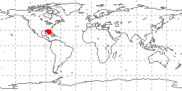
Browse image (thumbnail):
- maintenance or update frequency: notPlanned
- notes: Completed data set, no additions planned.
- Constraints
-
- Use limitation statement:
- Please cite the originator of the data set, the date downloaded, and the National Centers for Environmental Information, NOAA, as the source of the data.
- Constraints
-
- Use limitation statement:
- Produced by the NOAA National Centers for Environmental Information. Not subject to copyright protection within the United States.
- Legal Constraints
-
- use constraint: otherRestrictions
- Other constraints
- While every effort has been made to ensure that these data are accurate and reliable within the limits of the current state of the art, NOAA cannot assume liability for any damages caused by any errors or omissions in the data, nor as a result of the failure of the data to function on a particular system. NOAA makes no warranty, expressed or implied, nor does the fact of distribution constitute such a warranty.
- Security Constraints
-
- Classification unclassified
- Legal Constraints
-
- Access Constraints otherRestrictions
- Other constraints
- Access to this dataset is unrestricted.
Resource extent
- Extent description
- Gulf of Mexico offshore Mississippi, Alabama, and Florida
-
- westBoundLongitude -88.949
- eastBoundLongitude -82.248
- northBoundLatitude 30.305
- southBoundLatitude 25.647
Geographic Bounding Box - Temporal Extent
- Vertical Extent
-
- bottom -192
- top -10
Geographic Extent
Sampling Dates
1974-05-16
1978-02-20
- minimal documentation, added to NGDC grainsize database
- L. J. Doyle, University of Southern Florida, with funding from the National Oceanic and Atmospheric Administration (NOAA)
- individual Name Marine Geology Data Manager
- organisation Name DOC/NOAA/NESDIS/NCEI > National Centers for Environmental Information, NESDIS, NOAA, U.S. Department of Commerce
- position Name Marine Geology Data Manager
- Contact information
-
- Telephone
-
- Voice (303) 497-4603
- Fax (303) 497-6513
- Address
-
- 325 Broadway, Mail Code E/NE42, Boulder, CO, 80305-3328 Country USA
- electronic Mail Address geology.info@noaa.gov
Vector spatial representation information
-
- Geometric Objects
-
- geometric Object Type point
Coverage description
- Type of coverage content point
- Cell value attribute description: The Latitude and Longitude (point) from which a sample of sediment or rock was collected from the sea floor or a lakebed.
- Band
-
- descriptor Distance measured north or south from the equator. Distance north is positive, distance south is negative.
- sequence Identifier
-
- name Latitude
- Long Wavelength 90.00000
- Short Wavelength -90.00000
- units
- Band
-
- descriptor Longitude is measured from the Prime Meridian (which is the north/south line that runs through Greenwich, England), values measured east are positive and values measured west are negative.
- sequence Identifier
-
- name Longitude
- Long Wavelength 180.00000
- Short Wavelength -180.00000
- units
Coverage description
- Type of coverage content physicalMeasurement
- Cell value attribute description: Information about the location from which a sample of sediment or rock was collected from the sea floor or a lakebed.
- Band
-
- descriptor The depth from the surface of the water to the sea floor or lakebed at the location where a measurement was taken or sample collection was begun.
- sequence Identifier
-
- name Water Depth Meters
- Long Wavelength 23000
- Short Wavelength 0
- units
Coverage description
- Type of coverage content physicalMeasurement
- Cell value attribute description: Weight percent of particles within a specified size range.
- Band
-
- descriptor Percentage, by weight, of the particles from a sample or subsample that falls within a specified particle size range. The range may be expressed in milimeters or phi as inidcated in the dataset.
- sequence Identifier
-
- name weight percent
- Long Wavelength 0
- Short Wavelength 100
- units
Content information: feature catalog description
- Included With Dataset true
- Compliance Code false
- Feature Types
Reference system information
- Reference System Identifier
- Identifier string: urn:ogc:def:crs:EPSG:4326
- authority
-
- Title European Petroleum Survey Group (EPSG) Geodetic Parameter Registry
- publication Date 2008-11-12
- cited responsible party -
-
- organisation Name European Petroleum Survey Group
- Contact information
-
- Linkage for online resource
-
- name European Petroleum Survey Group Geodetic Parameter Dataset
- URL: http://www.epsg-registry.org/
- link function search
- Description Registry that accesses the EPSG Geodetic Parameter Dataset, which is a structured dataset of Coordinate Reference Systems and Coordinate Transformations.
- Version 6.18.3
quality statement 1
Scope of quality information
-
- dataset described: gov.noaa.ngdc.mgg.geology:G02890
- Lineage statement
- These data were contributed by the originator to NOAA's former National Oceanographic Data Center (NODC) and may be part of a larger compilation archived as oceanographic data by NCEI. Data were contributed on nine track magnetic tape in ASCII form, as 80 character records blocked to 4800 characters/block. Ten files of MAFLA data were followed by additional STOCS data on the tape, as described in a separate metadata record. Data files included cruises MAFLA002, MAFLA010, MAFLA011, MAFLA014, MAFLA021, MAFLA029, MAFLA039, MAFLADM1, MAFLADM2, and MAFLADM4 - 15,175 records of 073 grain size data with no significant errors, so they were added to the NGDC Seafloor Sediment Grain Size Database.
- Processing Step
-
- date and time 1985-03-20T00:00:00
- description From 1975 through the 1980s, most sediment data collected as part of offshore environmental baseline and/or habitat studies were part of a suite of measurements sent to NODC or NODC liasons. NODC data managers, primarily Francis Mitchel, then sent the sediment-related data (e.g., physical properties, composition, geochemstry, mineralogy) to the former NGDC as the authoritative archive and distribution point for sediment data. Many sediment analyses and descriptions, however, were maintained by NODC as benthic habitat data, and some additional sediment data were duplicated between the NODC and NGDC archives.
- source description L. J. Doyle, University of Southern Florida
- name Of Measure Horizontal Positional Accuracy
- measure Description
- evaluation Method Description The horizontal accuracy of data values is approximately .001 degree of latitude/longitude.
- name Of Measure Reliability
- measure Description
- evaluation Method Description Quality control was performed by the originator. NCEI performed basic out-of-range location testing.
quality statement 2
Scope of quality information
-
- other component described NOAA National Centers for Environmental Information
Resource distribution information
Distributor
- organisation Name DOC/NOAA/NESDIS/NCEI > National Centers for Environmental Information, NESDIS, NOAA, U.S. Department of Commerce
- position Name Data Manager
- Contact information
-
- Telephone
-
- Voice (303) 497-6338
- Fax (303) 497-6513
- Address
-
- 325 Broadway, Mail Code E/NE42, Boulder, CO, 80305-3328 Country USA
- electronic Mail Address geology.info@noaa.gov
- fees free online download
- Format name ASCII
- Format version
- transfer Size .6
- Linkage for online resource
-
- name Data files and documentation
- URL: https://www.ngdc.noaa.gov/mgg/geology/data/g02890/
- protocol WWW:LINK-1.0-http--link
- link function download
- Description Original data and documentation for MGGD 03995010.
- target application profile Web Browser
- name Database extract MGG03995010
- URL: https://www.ngdc.noaa.gov/mgg_grainsize/selectdisplay.jsp?mgg=03995010
- protocol WWW:LINK-1.0-http--link
- link function download
- Description Download grain size data for MGG03995010 in delimited form from the NGDC Seafloor Sediment Grain Size Database.
- target application profile Web Browser
- name Publisher's landing page
- URL: https://www.ngdc.noaa.gov/docucomp/page?xml=NOAA/NESDIS/NGDC/MGG/Geology/iso/xml/G02890.xml&view=getDataView&header=none
- protocol WWW:LINK-1.0-http--link
- link function information
- Description Information about the data set, all access options, and complete documentation.
- target application profile Web Browser
- date of next update: 2016-12-31
- maintenance or update frequency: annually
- notes: Metadata Review Date: 2016-12-31
- notes: This record was automatically modified on 2015-11-05 to include references to NCEI where applicable.
- individual Name Marine Geology Data Manager
- organisation Name DOC/NOAA/NESDIS/NCEI > National Centers for Environmental Information, NESDIS, NOAA, U.S. Department of Commerce
- position Name Marine Geology Data Manager
- Contact information
-
- Telephone
-
- Voice (303) 497-4603
- Fax (303) 497-6513
- Address
-
- 325 Broadway, Mail Code E/NE42, Boulder, CO, 80305-3328 Country USA
- electronic Mail Address geology.info@noaa.gov