Dataset Identification:
- The sediment data contained in this set were produced as part of the site description and monitoring phases of an aquaculture demonstration project. The site is located off the coast of New Hampshire in the Gulf of Maine.
- Title Sediment Data from off New Hampshire (WARD01 shapefile)
- publication Date 2003-01-01
- Name Open-File Report
- Issue 03-001
- organisation Name U. S. Geological Survey, Coastal and Marine Geology Program
- Contact information
-
- Address
-
- , Woods Hole Coastal and Marine Science Center, Woods Hole, MA
- organisation Name Lawrence J. Poppe
- organisation Name L.J. Poppe
- organisation Name V.F. Paskevich
- organisation Name S.J. Williams
- organisation Name M.E. Hastings
- organisation Name J.T. Kelley
- organisation Name D.F. Belknap
- organisation Name L.G. Ward
- organisation Name D.M. Fitzgerald
- organisation Name P.F. Larsen
- organisation Name
- Contact information
-
- Linkage for online resource
- organisation Name
- Contact information
-
- Linkage for online resource
Theme keywords (theme):
U.S. Geological Survey
USGS
Woods Hole Science Center
WHSC
Unversity of New Hampshire
UNH
sediment
texture
grain size
classification
gravel
sand
silt
clay
mud
Open-File Report 03-001
Coastal and Marine Geology Program
CMGP
sediment classification
surficial classification
point shapefile
points
GIS
Geographic Information System
- Title None
Location keywords:
New Hampshire
New England
Gulf of Maine
U.S. East Coast
Atlantic Ocean
U.S. East Coast
New Hampshire coast
- Title None
purpose:
Browse image (thumbnail):
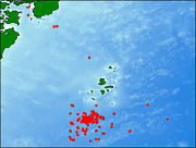
Browse image (thumbnail):

- maintenance or update frequency: notPlanned
- Constraints
-
- Use limitation statement:
- Although these data have been used by the U.S. Geological Survey (USGS), U.S. Department of the Interior (DOI), no warranty expressed or implied is made by the U.S. Geological Survey as to the accuracy of the data. The act of distribution shall not constitute any such warranty, and no responsibility is assumed by the USGS in the use of these data or related materials. Any use of trade, product, or firm names is for descriptive purposes only and does not imply endorsement by the U.S. Government.
- Legal Constraints
-
- use constraint: otherRestrictions
- Other constraints
- Use Constraints: Public domain data from the U.S. Government are freely redistributable with proper metadata and source attribution. Please recognize the U.S. Geological Survey (USGS) as the source of this information.
- Legal Constraints
-
- Access Constraints otherRestrictions
- Other constraints
- Access Constraints: None
Resource extent
-
- westBoundLongitude -70.701000
- eastBoundLongitude -70.536483
- northBoundLatitude 43.076667
- southBoundLatitude 42.918333
Geographic Bounding Box - Temporal Extent
Geographic Extent
1997-10-21
2002-07-19
- Please review the cross reference information for the original data set credit to Ward and others (2001), and Larry Poppe for creating this ArcView shapefile.
- individual Name Lawrence J. Poppe
- organisation Name U.S. Geological Survey
- position Name Geologist
- Contact information
-
- Telephone
-
- Voice (508) 548-8700 x2314
- Fax (508) 457-2310
- Address
-
- 384 Woods Hole Road, Woods Hole, MA, 02543-1598 Country USA
- electronic Mail Address lpoppe@usgs.gov
Vector spatial representation information
-
- Geometric Objects
-
- geometric Object Type point
- geometric Object Count 199
Grid spatial representation
- number of grid dimensions: 2
- Grid axis property:
-
- Grid Dimension
-
- Dimension Name: column
- Dimension Size
- Grid Dimension
-
- Dimension Name: row
- Dimension Size
- transformation parameter availability: false
Coverage description
- Type of coverage content
- Cell value attribute description:
- Band
-
- descriptor Internal feature number.
- sequence Identifier
-
- name FID
- Band
-
- descriptor Feature geometry.
- sequence Identifier
-
- name Shape
- Band
-
- descriptor Name used to designate this data set
- sequence Identifier
-
- name PROJECTID
- Band
-
- descriptor Date sample was collected
- sequence Identifier
-
- name DATE
- Band
-
- descriptor Name used to designate sampling locations
- sequence Identifier
-
- name STATION
- Band
-
- descriptor Devie used to collect samples
- sequence Identifier
-
- name DEVICE
- Band
-
- descriptor Top depth of sampling interval in cores
- sequence Identifier
-
- name T_DEPTH
- Long Wavelength 92
- Short Wavelength 2
- units
- Band
-
- descriptor Bottom depth of sampling interval in cores
- sequence Identifier
-
- name B_DEPTH
- Long Wavelength 94
- Short Wavelength 4
- units
- Band
-
- descriptor Water depth
- sequence Identifier
-
- name DEPTH_M
- Long Wavelength 74
- Short Wavelength 17
- units
- Band
-
- descriptor Latitude coordinate of sample location
- sequence Identifier
-
- name LATITUDE
- Long Wavelength 43.076667
- Short Wavelength 42.918333
- units
- Band
-
- descriptor Longitude coordinate of sample location
- sequence Identifier
-
- name LONGITUDE
- Long Wavelength -70.536483
- Short Wavelength -70.701000
- units
- Band
-
- descriptor Textural classification based on a gravel, sand, mud triangular diagram of Folk (1974)
- sequence Identifier
-
- name FOLK_GSM
- Band
-
- descriptor Textural classification based on a sand, silt, clay triangular diagram of Folk (1974)
- sequence Identifier
-
- name FOLK_SZC
- Band
-
- descriptor Textural classification based on a sand, silt, clay triangular diagram devised by Shepard (1954)
- sequence Identifier
-
- name SHEPARD_SZ
- Band
-
- descriptor Textural classification based on a sand, silt, clay triangular diagram devised by Shepard (1954) and modified by Schlee (1973)
- sequence Identifier
-
- name SEDCLASS
- Band
-
- descriptor Percentage of gravel in sample
- sequence Identifier
-
- name GRAVEL
- Long Wavelength 98
- Short Wavelength 0
- units
- Band
-
- descriptor Percentage of sand in sample
- sequence Identifier
-
- name SAND
- Long Wavelength 93
- Short Wavelength 1
- units
- Band
-
- descriptor Silt plus clay in sample
- sequence Identifier
-
- name MUD
- Long Wavelength 86
- Short Wavelength 1
- units
- Band
-
- descriptor Percentage of silt in sample
- sequence Identifier
-
- name SILT
- Long Wavelength 60
- Short Wavelength 2
- units
- Band
-
- descriptor Percentage of clay in sample
- sequence Identifier
-
- name CLAY
- Long Wavelength 30
- Short Wavelength 1
- units
- Band
-
- descriptor Mean of the size distribution
- sequence Identifier
-
- name MEAN
- Long Wavelength 6.77
- Short Wavelength -4.03
- units
- Band
-
- descriptor Standard deviation of the size distribution
- sequence Identifier
-
- name STDEV
- Long Wavelength 4.28
- Short Wavelength 0.56
- units
- Band
-
- descriptor Skewness of the size distribution
- sequence Identifier
-
- name SKEWNESS
- Long Wavelength 0.89
- Short Wavelength -2.29
- units
- Band
-
- descriptor Krtosis of the size distribution
- sequence Identifier
-
- name KURTOSIS
- Long Wavelength 8.81
- Short Wavelength 0.64
- units
- Band
-
- descriptor Percent weight loss on ignition
- sequence Identifier
-
- name LOI
- Long Wavelength 5.3
- Short Wavelength 0.7
- units
- Band
-
- descriptor Comments on sampling
- sequence Identifier
-
- name COMMENTS
Content information: feature catalog description
- Included With Dataset true
- Feature Types
Data quality information
Scope of quality information
- source
-
- source description Source Contribution: Information unavailable from original metadata.Source Type Excel File
- source citation
-
- Title University of New Hampshire Open Ocean Aquaculture Demonstration Project: Site Description and Environmental Monitoring, Report on Activities from Fall 1997 to Winter 2000
- publication Date 2001-01-01
- Edition 1.0
- Series
-
- Name NOAA/UNH Cooperative Institute for New England Mariculture and Fisheries (CINEMAR) Report
- Issue UNH CMB/JEL Report Series, Number 55
- cited responsible party - publisher
-
- organisation Name University of New Hampshire
- Contact information
-
- Address
-
- , Durham, NH
- organisation Name L.G. Ward
- organisation Name R.E. Grizzle
- organisation Name F.L. Bub
- organisation Name R. Langan
- organisation Name G. Schnaittacher
- organisation Name J.A. Dijkstra
Resource extent
- Temporal Extent
2001-01-01
- name Of Measure Horizontal Positional Accuracy Report
- evaluation Method Description Navigation was done with differential GPS (+/- 10 m)
- evaluation Method Description Sample locations, grain-size data, textural classifications, and sample identifiers are provided for 199 records
- evaluation Method Description Sample locations, grain-size data, textural classifications, and sample identifiers are provided for 199 records
- measure Description No additional checks for topological consistency were performed on this data.
Resource distribution information
Distributor
- individual Name Lawrence J. Poppe
- organisation Name U.S. Geological Survey
- position Name Geologist
- Contact information
-
- Telephone
-
- Voice (508) 548-8700 x2314
- Fax (508) 457-2310
- Address
-
- 384 Woods Hole Road, Woods Hole, MA, 02543-1598 Country USA
- electronic Mail Address lpoppe@usgs.gov
- fees None
- plannedAvailableDateTime 2003-01-01T00:00:00
- Format name SHP
- Format version 3.2
- specification > ESRI point shapefile
- file Decompression Technique zip
- transfer Size 0.1
- Linkage for online resource
-
- name SHP
- URL: http://pubs.usgs.gov/of/2003/of03-001/data/seddata/ward01/ward01.zip
- link function
- Description Five files (ward01.shp, ward01.dbf, ward01.shx, ward01.sbx, ward01.sbn) comprising the ArcView point shapefile components, 'prj' and 'avl' files, metadata text file and browse graphic.
- Medium of distribution
-
- name cdRom
- medium Format iso9660
- density 650
- density Units Mbytes
- medium Note Format Information Content: Five files (ward01.shp, ward01.dbf, ward01.shx, ward01.sbx, ward01.sbn) comprising the ArcView point shapefile components, 'prj' and 'avl' files, metadata text file and browse graphic. Compatibility Information: The user must have a computer system with a CD-ROM available. To browse the information contained on this CD-ROM, the user must have a current WWW browser available. The user must also have software installed on their computer to unzip the archived file.
- maintenance or update frequency: annually
- notes: This metadata was automatically generated from the FGDC Content Standards for Digital Geospatial Metadata standard (version FGDC-STD-001-1998) using the 2012-06-20T17:21:00 version of the FGDC RSE to ISO 19115-2 transform.
- Legal Constraints
-
- Access Constraints otherRestrictions
- Other constraints
- Metadata Access Constraints: None
- Legal Constraints
-
- Access Constraints otherRestrictions
- Other constraints
- Metadata Use Constraints: None
- individual Name Lawrence J. Poppe
- organisation Name U.S. Geological Survey
- position Name Geologist
- Contact information
-
- Telephone
-
- Voice (508) 548-8700 x2314
- Fax (508) 457-2310
- Address
-
- 384 Woods Hole Road, Woods Hole, MA, 02543-1598 Country USA
- electronic Mail Address lpoppe@usgs.gov