Dataset Identification:
- The relative resilience of coral reef sites was assessed at two depths in 2015, 2016, and 2017 (note: this map layer only includes the shallow locations). The surveys were conducted as a collaborative effort by SymbioSeas, Hawaii Division of Aquatic Resources (DAR), The Nature Conservancy (TNC), NOAA Coral Reef Ecosystem Program (CREP), and community organizations.
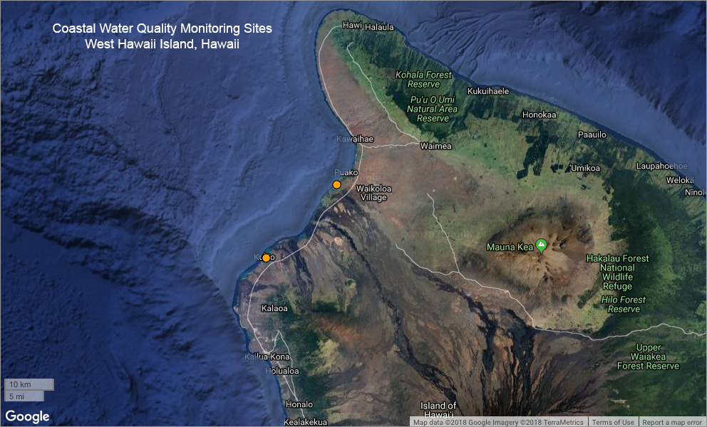
- Title Coastal Water Quality Monitoring Sites - West Hawaii Island, Hawaii
- creation Date 2018-11-02
- individual Name Jonathan Martinez
- organisation Name NOAA Habitat Blueprint
- Contact information
-
- Address
-
- electronic Mail Address jonathan.martinez@noaa.gov
- Linkage for online resource
-
- name
- URL: http://www.habitatblueprint.noaa.gov
- protocol http
- link function information
- Description
- target application profile web browser
- organisation Name Pacific Islands Ocean Observing System (PacIOOS)
- Contact information
-
- Address
-
- electronic Mail Address info@pacioos.org
- Linkage for online resource
-
- name
- URL: http://pacioos.org
- protocol http
- link function information
- Description
- target application profile web browser
Theme keywords (theme):
Earth Science > Biological Classification > Animals/Vertebrates > Fish
Earth Science > Biosphere > Aquatic Ecosystems > Reef Habitat
Earth Science > Human Dimensions > Environmental Governance/Management > Environmental Assessments
Earth Science > Oceans > Aquatic Sciences > Fisheries
Earth Science > Oceans > Coastal Processes > Coral Reefs
Earth Science > Oceans > Marine Environment Monitoring
Earth Science > Oceans > Water Quality
- Title GCMD Science Keywords
Location keywords:
Continent > North America > United States Of America > Hawaii
Ocean > Pacific Ocean > Central Pacific Ocean > Hawaiian Islands > Big Island
Ocean > Pacific Ocean > Central Pacific Ocean > Hawaiian Islands > Hawaii Island > North Kona
Ocean > Pacific Ocean > Central Pacific Ocean > Hawaiian Islands > Hawaii Island > South Kohala
- Title GCMD Location Keywords
project
Keywords
PacIOOS > Pacific Islands Ocean Observing System
- Title GCMD Project Keywords
dataCenter
Keywords
PacIOOS > Pacific Islands Ocean Observing System
- Title GCMD Data Center Keywords
Theme keywords (theme):
- Title Feature > Hydrologic Feature
- publication Date 2018-11-21
Theme keywords (theme):
- Title Science Domain > Earth Science
- publication Date 2018-11-21
Theme keywords (theme):
- Title Realm > Geosphere
- publication Date 2018-11-21
Theme keywords (theme):
- Title Organization > GOVERNMENT AGENCIES-U.S. FEDERAL AGENCIES
- publication Date 2018-11-21
Theme keywords (theme):
- Title Feature > Marine Feature
- publication Date 2018-11-21
Theme keywords (theme):
- Title Property > Property (Other)
- publication Date 2018-11-21
Theme keywords (theme):
- Title Material > Environmental Material
- publication Date 2018-11-21
Theme keywords (theme):
- Title Realm > Habitat
- publication Date 2018-11-21
Theme keywords (theme):
- Title Property > Measure
- publication Date 2018-11-21
Theme keywords (theme):
- Title Realm > marine
- publication Date 2018-11-21
Theme keywords (theme):
- Title Organization > CONSORTIA/INSTITUTIONS
- publication Date 2018-11-21
Theme keywords (theme):
- Title Activity > Observation
- publication Date 2018-11-21
purpose:
Browse image (thumbnail):
- Legal Constraints
-
- Use Limitation
- The data may be used and redistributed for free but is not intended for legal use, since it may contain inaccuracies. Neither the data Contributor, University of Hawaii, PacIOOS, NOAA, State of Hawaii nor the United States Government, nor any of their employees or contractors, makes any warranty, express or implied, including warranties of merchantability and fitness for a particular purpose, or assumes any legal liability for the accuracy, completeness, or usefulness, of this information.
Resource extent
-
- extent Type Code 1
- westBoundLongitude -155.9985472
- eastBoundLongitude -155.86282
- northBoundLatitude 19.9525472
- southBoundLatitude 19.8193056
Geographic Bounding Box
Geographic Extent
- The Pacific Islands Ocean Observing System (PacIOOS) is funded through the National Oceanic and Atmospheric Administration (NOAA) as a Regional Association within the U.S. Integrated Ocean Observing System (IOOS). PacIOOS is coordinated by the University of Hawaii School of Ocean and Earth Science and Technology (SOEST).
- individual Name Jonathan Martinez
- organisation Name NOAA Habitat Blueprint
- Contact information
-
- Address
-
- electronic Mail Address jonathan.martinez@noaa.gov
- Linkage for online resource
-
- name
- URL: http://www.habitatblueprint.noaa.gov
- protocol http
- link function information
- Description
- target application profile web browser
Service Identification information: 1
- The relative resilience of coral reef sites was assessed at two depths in 2015, 2016, and 2017 (note: this map layer only includes the shallow locations). The surveys were conducted as a collaborative effort by SymbioSeas, Hawaii Division of Aquatic Resources (DAR), The Nature Conservancy (TNC), NOAA Coral Reef Ecosystem Program (CREP), and community organizations.
- Title Coastal Water Quality Monitoring Sites - West Hawaii Island, Hawaii
- creation Date 2018-11-02
- individual Name Jonathan Martinez
- organisation Name NOAA Habitat Blueprint
- Contact information
-
- Address
-
- electronic Mail Address jonathan.martinez@noaa.gov
- Linkage for online resource
-
- name
- URL: http://www.habitatblueprint.noaa.gov
- protocol http
- link function information
- Description
- target application profile web browser
- organisation Name Pacific Islands Ocean Observing System (PacIOOS)
- Contact information
-
- Address
-
- electronic Mail Address info@pacioos.org
- Linkage for online resource
-
- name
- URL: http://pacioos.org
- protocol http
- link function information
- Description
- target application profile web browser
Resource extent
-
- extent Type Code 1
- westBoundLongitude -155.9985472
- eastBoundLongitude -155.86282
- northBoundLatitude 19.9525472
- southBoundLatitude 19.8193056
Geographic Bounding Box
Geographic Extent
- Operation name: GetCapabilities
- Linkage for online resource
-
- name OGC-WFS
- URL: http://geo.pacioos.hawaii.edu/geoserver/PACIOOS/hi_noaa_bigi_coastal_waterquality/ows?service=WFS&version=1.0.0&request=GetCapabilities
- protocol OGC:WFS
- link function download
- Description Open Geospatial Consortium Web Feature Service (WFS). Supported WFS versions include 1.0.0, 1.1.0, and 2.0.0. Supported output formats include CSV, GeoJSON, GeoJSON-P, GML, KML, and Shapefile (Zipped).
Service Identification information: 1
- The relative resilience of coral reef sites was assessed at two depths in 2015, 2016, and 2017 (note: this map layer only includes the shallow locations). The surveys were conducted as a collaborative effort by SymbioSeas, Hawaii Division of Aquatic Resources (DAR), The Nature Conservancy (TNC), NOAA Coral Reef Ecosystem Program (CREP), and community organizations.
- Title Coastal Water Quality Monitoring Sites - West Hawaii Island, Hawaii
- creation Date 2018-11-02
- individual Name Jonathan Martinez
- organisation Name NOAA Habitat Blueprint
- Contact information
-
- Address
-
- electronic Mail Address jonathan.martinez@noaa.gov
- Linkage for online resource
-
- name
- URL: http://www.habitatblueprint.noaa.gov
- protocol http
- link function information
- Description
- target application profile web browser
- organisation Name Pacific Islands Ocean Observing System (PacIOOS)
- Contact information
-
- Address
-
- electronic Mail Address info@pacioos.org
- Linkage for online resource
-
- name
- URL: http://pacioos.org
- protocol http
- link function information
- Description
- target application profile web browser
Resource extent
-
- extent Type Code 1
- westBoundLongitude -155.9985472
- eastBoundLongitude -155.86282
- northBoundLatitude 19.9525472
- southBoundLatitude 19.8193056
Geographic Bounding Box
Geographic Extent
- Operation name: GetCapabilities
- Linkage for online resource
-
- name OGC-WMS
- URL: http://geo.pacioos.hawaii.edu/geoserver/PACIOOS/hi_noaa_bigi_coastal_waterquality/ows?service=WMS&version=1.3.0&request=GetCapabilities
- protocol OGC:WMS
- link function download
- Description Open Geospatial Consortium Web Map Service (WMS). Supported WMS versions include 1.1.1 and 1.3.0. Supported map formats include AtomPub, GeoRSS, GeoTIFF, GIF, JPEG, KML/KMZ, PDF, PNG, SVG, and TIFF. Supported info formats include GeoJSON, GeoJSON-P, GML, HTML, and plain text.
Service Identification information: 1
- The relative resilience of coral reef sites was assessed at two depths in 2015, 2016, and 2017 (note: this map layer only includes the shallow locations). The surveys were conducted as a collaborative effort by SymbioSeas, Hawaii Division of Aquatic Resources (DAR), The Nature Conservancy (TNC), NOAA Coral Reef Ecosystem Program (CREP), and community organizations.
- Title Coastal Water Quality Monitoring Sites - West Hawaii Island, Hawaii
- creation Date 2018-11-02
- organisation Name NOAA Habitat Blueprint
- Contact information
-
- Linkage for online resource
-
- name
- URL: http://www.habitatblueprint.noaa.gov
- protocol http
- link function information
- Description
- target application profile web browser
- organisation Name Pacific Islands Ocean Observing System (PacIOOS)
- Contact information
-
- Address
-
- electronic Mail Address info@pacioos.org
- Linkage for online resource
-
- name
- URL: http://pacioos.org
- protocol http
- link function information
- Description
- target application profile web browser
Resource extent
-
- extent Type Code 1
- westBoundLongitude -155.9985472
- eastBoundLongitude -155.86282
- northBoundLatitude 19.9525472
- southBoundLatitude 19.8193056
Geographic Bounding Box
Geographic Extent
- Operation name: GetCapabilities
- Linkage for online resource
-
- name OGC-WMS-C
- URL: http://geo.pacioos.hawaii.edu/geoserver/PACIOOS/gwc/service/wms?service=WMS&version=1.1.1&request=GetCapabilities&tiled=true
- protocol OGC:WMS-C
- link function download
- Description Open Geospatial Consortium Web Map Service - Cached (WMS-C). Use of WMS-C is similar to traditional WMS but with the addition of the "tiled=true" parameter, which triggers GeoServer to pull map tiles from GeoWebCache if they have been previously generated. This can dramatically improve performance, especially for larger datasets. Supported map formats include JPEG and PNG. Supported info formats include GeoJSON, GML, HTML, and plain text.
Grid spatial representation
- number of grid dimensions: 2
- Grid axis property:
-
- Grid Dimension
-
- Dimension Name: column
- Dimension Size
- Grid Dimension
-
- Dimension Name: row
- Dimension Size
- cell geometry type: area
- transformation parameter availability:
- descriptor
- sequence Identifier
-
- name geom
- attribute Type
-
- Name gml:PointPropertyType
- descriptor
- sequence Identifier
-
- name latitude
- attribute Type
-
- Name decimal
- descriptor
- sequence Identifier
-
- name longitude
- attribute Type
-
- Name decimal
Data quality information
Scope of quality information
- Lineage statement
- OGC web services (WMS and WFS) enabled by PacIOOS via GeoServer. Original data from source provider may have been reformatted, reprojected, or adjusted in other ways to optimize these capabilities.
Resource distribution information
Distributor
- individual Name
- organisation Name Pacific Islands Ocean Observing System (PacIOOS)
- Contact information
-
- Address
-
- electronic Mail Address info@pacioos.org
- Linkage for online resource
-
- name URL for the data publisher
- URL: http://pacioos.org
- protocol http
- link function information
- Description This URL provides contact information for the publisher of this dataset
- target application profile web browser
- Linkage for online resource
-
- name GeoServer
- URL: http://geo.pacioos.hawaii.edu/geoserver/
- protocol http
- link function download
- Description This URL provides access to this dataset via GeoServer, which offers multiple output formats and an OpenLayers viewer.
- Linkage for online resource
-
- name GeoExplorer
- URL: http://geo.pacioos.hawaii.edu/geoexplorer/
- protocol http
- link function download
- Description This URL provides a viewer for this dataset.
- Linkage for online resource
-
- name PacIOOS: NOAA Habitat Blueprint West Hawaii Habitat Focus Area
- URL: http://pacioos.org/projects/westhawaii/
- protocol http
- link function information
- Description This URL provides a viewer for this dataset.
- maintenance or update frequency:
- notes: This record was translated from GeoServer OGC Web Services (OWS) using PacIOOS software.
- individual Name Jonathan Martinez
- organisation Name NOAA Habitat Blueprint
- Contact information
-
- Address
-
- electronic Mail Address jonathan.martinez@noaa.gov
- Linkage for online resource
-
- name
- URL: http://www.habitatblueprint.noaa.gov
- protocol http
- link function information
- Description
- target application profile web browser