Dataset Identification:
- Elevation maps (also known as Digital Elevation Models or DEMs) of Padre Island National Seashore were produced from remotely-sensed, geographically-referenced elevation measurements in cooperation with NASA and NPS. Point data in ascii text files were interpolated in a GIS to create a grid or digital elevation model (DEM) of each beach surface. Elevation measurements were collected in Texas, over Padre Island National Seashore, using the NASA Experimental Advanced Airborne Research Lidar (EAARL), a pulsed laser ranging system mounted onboard an aircraft to measure ground elevation and coastal topography. The system uses high frequency laser beams directed at the earth's surface through an opening in the bottom of the aircraft's fuselage. The laser system records the time difference between emission of the laser beam and the reception of the reflected laser signal in the aircraft. The plane travels over the beach at approximately 60 meters per second while surveying from the low-water line to the landward base of the sand dunes. The EAARL, developed by the National Aeronautics and Space Administration (NASA) located at Wallops Flight Facility in Virginia, measures ground elevation with a vertical resolution of 15 centimeters. A sampling rate of 3 kHz or higher results in an extremely dense spatial elevation data set. Over 100 kilometers of coastline can be easily surveyed within a 3- to 4-hour mission time period. The ability to sample large areas rapidly and accurately is especially useful in morphologically dynamic areas such as barrier beaches. Quick assessment of topographic change can be made following storms comparing measurements against baseline data. When subsequent elevation maps for an area are analyzed, they provide a useful tool to make management decisions regarding coastal development. For more information on Lidar science and the Experimental Advanced Airborne Research Lidar (EAARL) system and surveys, see http://ngom.usgs.gov/dsp/overview/index.php and http://ngom.usgs.gov/dsp/tech/eaarl/index.php .
- Title EAARL Topography-Padre Island National Seashore
- publication Date 2007-01-01
- Name Open File Report
- Issue 2007-1431
- organisation Name USGS
- Contact information
-
- Address
-
- , St. Petersburg, FL
- organisation Name United States Geological Survey, FISC St. Petersburg
- organisation Name
- Contact information
-
- Linkage for online resource
Theme keywords (theme):
Lidar
Experimental Advanced Airborne Research Lidar
digital elevation model
elevation change
laser altimetry
derived surface
resource management
bare earth elevation
ALPS
Airborne Lidar Processing System
- Title None
Theme keywords (theme):
distributions
bathymetry and elevation
- Title Data Categories for Marine Planning
Theme keywords (theme):
altimetry
topographic mapping
- Title Marine Realms Information Bank (MRIB) Keywords
Theme keywords (theme):
LIDAR
topography
digital elevation models
- Title USGS Thesaurus
Location keywords:
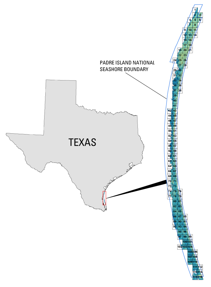
Padre Island National Seashore
Texas
United States Gulf of Mexico
- Title None
Stratum keywords:
bare earth topography
- Title None
purpose:
Browse image (thumbnail):
- maintenance or update frequency: unknown
- Constraints
-
- Use limitation statement:
- The United States Geological Survey shall not be held liable for improper or incorrect use of the data described and/or contained herein. These data and related graphics are not legal documents and are not intended to be used as such.The information contained in these data is dynamic and may change over time. The data are not better than the original sources from which they were derived. It is the responsibility of the data user to use the data appropriately and consistent within the limitations of geospatial data in general and these data in particular. The related graphics are intended to aid the data user in acquiring relevant data; it is not appropriate to use the related graphics as data.The United States Geological Survey gives no warranty, expressed or implied, as to the accuracy, reliability, or completeness of these data. It is strongly recommended that these data are directly acquired from an USGS server and not indirectly through other sources which may have changed the data in some way. Although these data have been processed successfully on a computer system at the United States Geological Survey, no warranty expressed or implied is made regarding the utility of the data on another system or for general or scientific purposes, nor shall the act of distribution constitute any such warranty. This disclaimer applies both to individual use of the data and aggregate use with other data.
- Legal Constraints
-
- use constraint: otherRestrictions
- Other constraints
- Use Constraints: Although the U. S. Geological Survey is making these data sets available to others who may find the data of value, U. S. Geological Survey does not warrant, endorse, or recommend the use of thes data for any given purpose. The user assumes the entire risk related to the use of these data. These data sets are not for navigational purposes. U. S. Geological Survey is providing these data "as is", and U. S. Geological Survey disclaims any and all warranties, whether expressed or implied, including (without limitation) any implied warranties of merchantability or fitness for a particular purpose. In no event will U. S. Geological Survey be liable to you or to any third party for any direct, indirect, incidental, consequential, special, or exemplary damages or lost profits resulting from any use or misuse of these data.Acknowledgement of the U.S. Geological Survey, FISC St. Petersburg as a data source would be appreciated in products developed from these data, and such acknowledgement as is standad for citation and legal practices for data source is expected by users of this data. Sharing new data layers developed directly from these data would also be appreciated by U. S. Geological Survey staff. Users should be aware that comparisons with other data sets for the same area from other time periods may be inaccurate due to inconsistencies resulting from changes in photo interpretation, mapping conventions, and digital processes over time. These data are not legal documents and are not to be used as such.
- Legal Constraints
-
- Access Constraints otherRestrictions
- Other constraints
- Access Constraints: Any use of these data signifies a user's agreement to comprehension and compliance of the U. S. Geological Survey Standard Disclaimer. Ensure all portions of metadata are read and clearly understood before using these data in order to protect both user and U. S. Geological Survey interests. See section 6.3 Distribution Liability.
Resource extent
-
- westBoundLongitude -97.399643
- eastBoundLongitude -97.268904
- northBoundLatitude 27.518209
- southBoundLatitude 26.561368
Geographic Bounding Box - Temporal Extent
Geographic Extent
- Raw Lidar data is not in a format that is generally usable by National Park Service resource managers and scientists for scientific analysis. Converting dense Lidar elevation data into a readily usable format without loss of essential information requires specialized processing. The USGS converts raw Lidar data into a GIS-compatible map product to be provided to National Park Service GIS specialists, managers, and scientists. The primary tool used in the conversion process is Airborne Lidar Processing System (ALPS), a multitiered processing system developed by a USGS/NASA collaborative for the use of topographic Lidar in coastal change assessment. Specialized processing algorithms are used to convert raw waveform Lidar data acquired by the EAARL to georeferenced spot (x,y,z) returns for "first return" and "bare earth" topography. These data are then converted to the NAD83 horizontal and NAVD88 vertical datum (using the Geoid 99 model). The final products are 2x2-km map tiles written out in a standard geotiff format with associated metadata information. These tiles are created for visual interpretation and regional quantitative analysis. Metadata files include the standard FGDC format.
- The U. S. Geological Survey, FISC St. Petersburg, would like to acknowledge NASA Goddard Space Flight Center for their cooperation and assistance in the development of the data. The U. S. Geological Survey would also like to acknowledege National Park Service management and personnel at Padre Island National Seashore.
- individual Name Dr. John C. Brock
- organisation Name United States Geological Survey, FISC St. Petersburg
- position Name Physical Oceanographer
- Contact information
-
- Telephone
-
- Voice 727 803-8747 ext3088
- Fax 727 803-2031
- Address
-
- 600 4th Street South, St. Petersburg, Florida, 33701 Country USA
- electronic Mail Address jbrock@usgs.gov
Grid spatial representation
- number of grid dimensions: 3
- Grid axis property:
-
- Grid Dimension
-
- Dimension Name: row
- Dimension Size 2000
- Grid Dimension
-
- Dimension Name: column
- Dimension Size 2000
- Grid Dimension
-
- Dimension Name: vertical
- Dimension Size 1
- cell geometry type: area
- transformation parameter availability:
Content information: feature catalog description
- Included With Dataset false
Data quality information
Scope of quality information
- name Of Measure Horizontal Positional Accuracy Report
- evaluation Method Description Raw elevation measurements have been determined to be within 1.5 meter horizontal accuracy. Processing steps (grid interpolation) may introduce additional error which has not been tested at the time of this publication.
- name Of Measure Vertical Positional Accuracy Report
- evaluation Method Description Elevations of the DEM are vertically consistent with the point elevation data, +/- 15cm.
- evaluation Method Description unknown
- evaluation Method Description unknown
- measure Description unknown
Resource distribution information
Distributor
- organisation Name United States Geological Survey, FISC St. Petersburg
- Contact information
-
- Telephone
-
- Voice 727-803-8747
- Address
-
- 600 4th Street South, St. Petersburg, FL, 33701 Country USA
- Call Office for Details
- fees Vary
- plannedAvailableDateTime 9999-01-01T00:00:00
- Ordering Instructions Access Instructions: Data can be downloaded via the World Wide Web (WWW) Ordering Instructions: Call USGS for details Custom Order Process: Call USGS for Details
- Format name GeoTIFF
- Format version
- transfer Size 15.275
- Linkage for online resource
-
- name GeoTIFF
- URL: http://pubs.usgs.gov/of/2007/1431/HTML/data.html
- link function
- Description
- Medium of distribution
-
- name dvdRom
- medium Format DVD-ROM
- maintenance or update frequency: annually
- notes: This metadata was automatically generated from the FGDC Content Standards for Digital Geospatial Metadata standard (version FGDC-STD-001-1998) using the 2012-06-20T17:21:00 version of the FGDC RSE to ISO 19115-2 transform.
- individual Name Laurinda J. Travers
- organisation Name US Geological Survey, FISC St. Petersburg
- Contact information
-
- Telephone
-
- Voice 727-803-8747
- Address
-
- 600 4th Street South, St. Petersburg, Florida, 33701 Country USA
- Call Survey for Details