Dataset Identification:
- LiDAR is a remote sensing technique that uses laser light to detect, range, or identify remote objects based on light reflected by the object or emitted through it subsequent fluorescence. Airborne ranging LiDAR is now being applied in coastal environments to produce accurate, cost-efficient elevation datasets with high data density. The USGS in cooperation with NASA and NPS is using airborne LiDAR to measure the topography of Assateague Island National Seashore land features. Elevation measurements were collected over Assateague Island National Seashore using the NASA Experimental Advanced Airborne Research LiDAR (EAARL), a pulsed laser ranging system mounted onboard an aircraft to measure subaerial and submarine coastal topography. With the NASA EAARL LiDAR system, submarine data is generally acquired to a maximum of approximately 1.5 secchi depths (a measure of water clarity). The system uses a high frequency laser beam directed at the earth's surface through an opening in the bottom of the aircraft's fuselage. The laser system records the time difference between emission of the laser beam and the reception of the reflected laser signal in the aircraft. The Experimental Advanced Airborne Research LiDAR, developed by the NASA Wallops Flight Facility (WFF) in Virginia, measures ground elevation with a vertical resolution of roughly 15 centimeters. A sampling rate of up to 3 kHz results in an extremely dense spatial elevation data set. For more information on Lidar science and the Experimental Advanced Airborne Research Lidar (EAARL) system and surveys, see http://ngom.usgs.gov/dsp/overview/index.php and http://ngom.usgs.gov/dsp/tech/eaarl/index.php .
- Title EAARL Topography-Assateague Island National Seashore-Lidar GeoTIFF
- publication Date 2007-01-01
- Name EAARL Lidar Submarine Topographic Maps
- Issue 1176
- organisation Name United States Geological Survey, FISC St. PetersburgCenter for Coastal and Watershed Studies
- organisation Name
- Contact information
-
- Linkage for online resource
Theme keywords (theme):
LiDAR
Experimental Advanced Airborne Research Lidar
digital elevation model
elevation change
laser altimetry
derived surface
coastal resource management
submerged topography
Airborne LiDAR Processing System
benthic cover types
bare earth elevations
- Title None
Location keywords:
Assateague Island National Seashore
Atlantic Coast
Virginia
United States East Coast
Maryland
- Title None
Theme keywords (theme):
- Title Activity > Observation
- publication Date 2016-11-13
Theme keywords (theme):
- Title Feature > Hydrologic Feature
- publication Date 2016-11-13
Theme keywords (theme):
- Title Material > Environmental Material
- publication Date 2016-11-13
Theme keywords (theme):
- Title Property > Measure
- publication Date 2016-11-13
Theme keywords (theme):
- Title Thing > Process
- publication Date 2016-11-13
Theme keywords (theme):
- Title Virtual International Authority File (VIAF) Corporate Names
- publication Date 2016-11-13
Theme keywords (theme):
- Title Feature > Physiographic Feature
- publication Date 2016-11-13
Theme keywords (theme):
- Title Realm > Geosphere
- publication Date 2016-11-13
Theme keywords (theme):
- Title Organization > GOVERNMENT AGENCIES-U.S. FEDERAL AGENCIES
- publication Date 2016-11-13
Theme keywords (theme):
- Title Realm > Earth Surface
- publication Date 2016-11-13
Theme keywords (theme):
- Title Equipment > Instrument
- publication Date 2016-11-13
Theme keywords (theme):
- Title Equipment > platform
- publication Date 2016-11-13
Theme keywords (theme):
- Title Feature > Marine Feature
- publication Date 2016-11-13
Theme keywords (theme):
- Title Thing > Method
- publication Date 2016-11-13
purpose:
Browse image (thumbnail):
- maintenance or update frequency: unknown
- Constraints
-
- Use limitation statement:
- The United States Geological Survey (USGS) shall not be held liable for improper or incorrect use of the data described and/or contained herein. These data and related graphics are not legal documents and are not intended to be used as such.The information contained in these data is dynamic and may change over time. The data are not better than the original sources from which they were derived. It is the responsibility of the data user to use the data appropriately and consistent within the limitations of geospatial data in general and these data in particular. The related graphics are intended to aid the data user in acquiring relevant data; it is not appropriate to use the related graphics as data.The USGS gives no warranty, expressed or implied, as to the accuracy, reliability, or completeness of these data. It is strongly recommended that these data are directly acquired from an USGS server and not indirectly through other sources which may have changed the data in some way. Although these data have been processed successfully on a computer system at the USGS, no warranty expressed or implied is made regarding the utility of the data on another system or for general or scientific purposes, nor shall the act of distribution constitute any such warranty. This disclaimer applies both to individual use of the data and aggregate use with other data.
- Legal Constraints
-
- use constraint: otherRestrictions
- Other constraints
- Use Constraints: Although the USGS is making these data sets available to others who may find the data of value, USGS does not warrant, endorse, or recommend the use of thes data for any given purpose. The user assumes the entire risk related to the use of these data. These data sets are not for navigational purposes. USGS is providing these data "as is", and USGS disclaims any and all warranties, whether expressed or implied, including (without limitation) any implied warranties of merchantability or fitness for a particular purpose. In no event will USGS be liable to you or to any third party for any direct, indirect, incidental, consequential, special, or exemplary damages or lost profits resulting from any use or misuse of these data.Acknowledgement of the U.S. Geological Survey Center for Coastal and Watershed Studies as a data source would be appreciated in products developed from these data, and such acknowledgement as is standad for citation and legal practices for data source is expected by users of this data. Sharing new data layers developed directly from these data would also be appreciated by USGS staff. Users should be aware that comparisons with other data sets for the same area from other time periods may be inaccurate due to inconsistencies resulting from changes in photo interpretation, mapping conventions, and digital processes over time. These data are not legal documents and are not to be used as such.
- Legal Constraints
-
- Access Constraints otherRestrictions
- Other constraints
- Access Constraints: Any use of these data signifies a user's agreement to comprehension and compliance of the USGS Standard Disclaimer. Ensure all portions of metadata are read and clearly understood before using these data in order to protect both user and USGS interests. See section 6.3 Distribution Liability.
Resource extent
-
- westBoundLongitude -75.35183
- eastBoundLongitude -75.080075
- northBoundLatitude 38.317083
- southBoundLatitude 37.847849
Geographic Bounding Box - Temporal Extent
Geographic Extent
- Raw LiDAR data is not in a format that is generally usable by resource managers and scientists for scientific analysis. Converting dense LiDAR elevation data into a readily usable format without loss of essential information requires specialized processing. The USGS converts raw LiDAR data into a GIS-compatible map product to be provided to National Park Service GIS specialists, managers, and scientists. The primary tool used in the conversion process is Airborne LiDAR Processing System (ALPS), a multi-tiered processing system developed by a USGS/NASA collaborative project for the use of subaerial and submarine LiDAR in coastal change assessment. Specialized processing algorithms are used to convert raw waveform LiDAR data acquired by the EAARL to georeferenced spot (x,y,z) returns for topography. These data are then converted to the NAD83 horizontal and NAVD88 vertical datum (using the Geoid 99 model). The final products are 2x2-km map tiles written out in a standard geotiff format with associated metadata information. These tiles are created for visual interpretation and regional quantitative analysis. Metadata files include the standard FGDC format.
- The USGS Center for Coastal and Watershed Studies would like to acknowledge NASA Goddard Space Flight Center for their cooperation and assistance in the development of the data. The USGS would also like to acknowledge Park Management and personnel at Assateague Island National Seashore.
- individual Name Dr. John C. Brock
- organisation Name United States Geological Survey, Center for Coastal and Watershed Studies
- position Name Research Oceanographer
- Contact information
-
- Telephone
-
- Voice 727 803-8747 ext3088
- Fax 727 803-2031
- Address
-
- 600 4th Street South, St. Petersburg, Florida, 33701- Country USA
- electronic Mail Address jbrock@usgs.gov
Grid spatial representation
- number of grid dimensions: 3
- Grid axis property:
-
- Grid Dimension
-
- Dimension Name: row
- Dimension Size 2000
- Grid Dimension
-
- Dimension Name: column
- Dimension Size 2000
- Grid Dimension
-
- Dimension Name: vertical
- Dimension Size 1
- cell geometry type: point
- transformation parameter availability:
Content information: feature catalog description
- Included With Dataset false
Data quality information
Scope of quality information
- source
-
- source description Source Contribution: noneSource Type Point elevation measurements collected by the EAARL sensor.
- source citation
-
- Title EAARL Topography-Assateague Island National Seashore
- publication Date 2007-01-01
- presentationForm mapDigital
- cited responsible party - originator
-
- organisation Name NASA Collected the EAARL LiDAR data and distributed to USGS for processing
Resource extent
- Temporal Extent
2004-08-24
- name Of Measure Horizontal Positional Accuracy Report
- evaluation Method Description Raw elevation measurements have been determined to be within 1 meter horizontal accuracy. Processing steps (grid interpolation) may introduce additional error which has not been tested at the time of this publication.
- name Of Measure Vertical Positional Accuracy Report
- evaluation Method Description Elevations of the DEM are vertically consistent with the point elevation data, +/-20 cm.
- evaluation Method Description Several regions of the dataset are labeled as "No Data", which corresponds to a cell value of -100 m in the GeoTiff file. These "No Data" areas are a result of the survey not covering a particular region, optical water depth of greater than 1.5 Secchi disc depths, or the manual removal of lidar processing artifacts.
- evaluation Method Description Several regions of the dataset are labeled as "No Data", which corresponds to a cell value of -100 m in the GeoTiff file. These "No Data" areas are a result of the survey not covering a particular region, optical water depth of greater than 1.5 Secchi disc depths, or the manual removal of lidar processing artifacts.
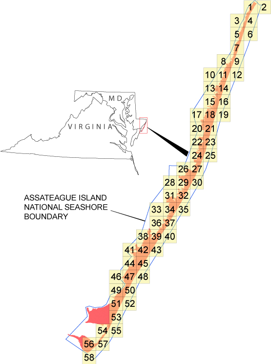
- measure Description Each file contains data located in a 2-km by 2-km tile, where the upper-left bound can be assessed quickly through the file name. The first 3 numbers in the file name represent the left-most UTM easting coordinate (e###000) in meters, the next 4 numbers represent the top-most UTM northing coordinate (n####000) in meters, and the last 2 numbers (##) represent the UTM zone in which the tile is located (for example, ba_e123_n4567_20).
Resource distribution information
Distributor
- individual Name Amar Nayegandhi
- organisation Name United States Geological Survey, FISC St. Petersburg
- position Name Computer Scientist
- Contact information
-
- Telephone
-
- Voice 727-803-8747
- Address
-
- 600 4th Street South, St. Petersburg, FL, 33701 Country USA
- fees Vary
- Ordering Instructions Ordering Instructions: Contact U.S. Geological Survey. Custom Order Process: Call USGS for Details
- turnaround
- Vary
- Format name TIFF
- Format version 2007
- specification > GeoTIFF
- Medium of distribution
-
- name dvd
- medium Format DVD
- maintenance or update frequency: annually
- notes: This metadata was automatically generated from the FGDC Content Standards for Digital Geospatial Metadata standard (version FGDC-STD-001-1998) using the 2012-06-20T17:21:00 version of the FGDC RSE to ISO 19115-2 transform.
- organisation Name United States Geological Survey, FISC St. Petersburg
- Contact information
-
- Telephone
-
- Voice 727-803-8747
- Address
-
- 600 4th Street South, St. Petersburg, Florida, 33704 Country USA
- Call Survey for Details