Dataset Identification:
- A 10-meter resolution land surface digital elevation model (DEM) grayscale hillshade for Big Island in Hawaii derived from United States Geological Survey (USGS) 1/3 arc-second DEM quadrangles.
- Title USGS 10-m Digital Elevation Model (DEM): Hawaii: Big Island: Hillshade
- creation Date 2016-01-25
- organisation Name United States Geological Survey (USGS)
- Contact information
-
- Linkage for online resource
-
- name
- URL: http://nationalmap.gov/viewer.html
- protocol http
- link function information
- Description
- target application profile web browser
- organisation Name Pacific Islands Ocean Observing System (PacIOOS)
- Contact information
-
- Address
-
- electronic Mail Address info@pacioos.org
- Linkage for online resource
-
- name
- URL: http://pacioos.org
- protocol http
- link function information
- Description
- target application profile web browser
Theme keywords (theme):
Earth Science > Land Surface > Topography > Terrain Elevation > Topographical Relief Maps
- Title GCMD Science Keywords
Location keywords:
Continent > North America > United States Of America > Hawaii
Ocean > Pacific Ocean > Central Pacific Ocean > Hawaiian Islands > Big Island
- Title GCMD Location Keywords
project
Keywords
PacIOOS > Pacific Islands Ocean Observing System
- Title GCMD Project Keywords
dataCenter
Keywords
PacIOOS > Pacific Islands Ocean Observing System
- Title GCMD Data Center Keywords
Theme keywords (theme):
- Title Feature > Hydrologic Feature
- publication Date 2018-11-21
Theme keywords (theme):
- Title Science Domain > Earth Science
- publication Date 2018-11-21
Theme keywords (theme):
- Title Realm > Geosphere
- publication Date 2018-11-21
Theme keywords (theme):
- Title Organization > GOVERNMENT AGENCIES-U.S. FEDERAL AGENCIES
- publication Date 2018-11-21
Theme keywords (theme):
- Title Feature > Marine Feature
- publication Date 2018-11-21
Theme keywords (theme):
- Title Feature > Physiographic Feature
- publication Date 2018-11-21
Theme keywords (theme):
- Title Property > Measure
- publication Date 2018-11-21
Theme keywords (theme):
- Title Virtual International Authority File (VIAF) Corporate Names
- publication Date 2018-11-21
Theme keywords (theme):
- Title Organization > CONSORTIA/INSTITUTIONS
- publication Date 2018-11-21
Theme keywords (theme):
- Title Activity > Observation
- publication Date 2018-11-21
purpose:
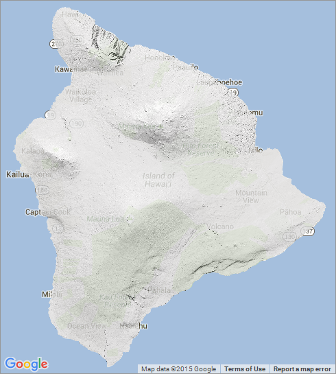
Browse image (thumbnail):
- Legal Constraints
-
- Use Limitation
- The data may be used and redistributed for free but is not intended for legal use, since it may contain inaccuracies. Neither the data Contributor, University of Hawaii, PacIOOS, NOAA, State of Hawaii nor the United States Government, nor any of their employees or contractors, makes any warranty, express or implied, including warranties of merchantability and fitness for a particular purpose, or assumes any legal liability for the accuracy, completeness, or usefulness, of this information.
Resource extent
-
- extent Type Code 1
- westBoundLongitude -156.1249092582994
- eastBoundLongitude -154.75666446501296
- northBoundLatitude 20.310743142046157
- southBoundLatitude 18.86175736887573
Geographic Bounding Box
Geographic Extent
- The Pacific Islands Ocean Observing System (PacIOOS) is funded through the National Oceanic and Atmospheric Administration (NOAA) as a Regional Association within the U.S. Integrated Ocean Observing System (IOOS). PacIOOS is coordinated by the University of Hawaii School of Ocean and Earth Science and Technology (SOEST).
- organisation Name United States Geological Survey (USGS)
- Contact information
-
- Linkage for online resource
-
- name
- URL: http://nationalmap.gov/viewer.html
- protocol http
- link function information
- Description
- target application profile web browser
Service Identification information: 1
- A 10-meter resolution land surface digital elevation model (DEM) grayscale hillshade for Big Island in Hawaii derived from United States Geological Survey (USGS) 1/3 arc-second DEM quadrangles.
- Title USGS 10-m Digital Elevation Model (DEM): Hawaii: Big Island: Hillshade
- creation Date 2016-01-25
- organisation Name United States Geological Survey (USGS)
- Contact information
-
- Linkage for online resource
-
- name
- URL: http://nationalmap.gov/viewer.html
- protocol http
- link function information
- Description
- target application profile web browser
- organisation Name Pacific Islands Ocean Observing System (PacIOOS)
- Contact information
-
- Address
-
- electronic Mail Address info@pacioos.org
- Linkage for online resource
-
- name
- URL: http://pacioos.org
- protocol http
- link function information
- Description
- target application profile web browser
Resource extent
-
- extent Type Code 1
- westBoundLongitude -156.1249092582994
- eastBoundLongitude -154.75666446501296
- northBoundLatitude 20.310743142046157
- southBoundLatitude 18.86175736887573
Geographic Bounding Box
Geographic Extent
- Operation name: GetCapabilities
- Linkage for online resource
-
- name OGC-WCS
- URL: http://geo.pacioos.hawaii.edu/geoserver/PACIOOS/hi_usgs_bigi_dem10m_hillshade/ows?service=WCS&version=1.0.0&request=GetCapabilities
- protocol OGC:WCS
- link function download
- Description Open Geospatial Consortium Web Coverage Service (WCS). Supported WCS versions include 1.0.0, 1.1.0, and 1.1.1. Supported output formats include GeoTIFF, GIF, JPEG, PNG, or TIFF.
Service Identification information: 1
- A 10-meter resolution land surface digital elevation model (DEM) grayscale hillshade for Big Island in Hawaii derived from United States Geological Survey (USGS) 1/3 arc-second DEM quadrangles.
- Title USGS 10-m Digital Elevation Model (DEM): Hawaii: Big Island: Hillshade
- creation Date 2016-01-25
- organisation Name United States Geological Survey (USGS)
- Contact information
-
- Linkage for online resource
-
- name
- URL: http://nationalmap.gov/viewer.html
- protocol http
- link function information
- Description
- target application profile web browser
- organisation Name Pacific Islands Ocean Observing System (PacIOOS)
- Contact information
-
- Address
-
- electronic Mail Address info@pacioos.org
- Linkage for online resource
-
- name
- URL: http://pacioos.org
- protocol http
- link function information
- Description
- target application profile web browser
Resource extent
-
- extent Type Code 1
- westBoundLongitude -156.1249092582994
- eastBoundLongitude -154.75666446501296
- northBoundLatitude 20.310743142046157
- southBoundLatitude 18.86175736887573
Geographic Bounding Box
Geographic Extent
- Operation name: GetCapabilities
- Linkage for online resource
-
- name OGC-WMS
- URL: http://geo.pacioos.hawaii.edu/geoserver/PACIOOS/hi_usgs_bigi_dem10m_hillshade/ows?service=WMS&version=1.3.0&request=GetCapabilities
- protocol OGC:WMS
- link function download
- Description Open Geospatial Consortium Web Map Service (WMS). Supported WMS versions include 1.1.1 and 1.3.0. Supported map formats include AtomPub, GeoRSS, GeoTIFF, GIF, JPEG, KML/KMZ, PDF, PNG, SVG, and TIFF. Supported info formats include GeoJSON, GeoJSON-P, GML, HTML, and plain text.
Service Identification information: 1
- A 10-meter resolution land surface digital elevation model (DEM) grayscale hillshade for Big Island in Hawaii derived from United States Geological Survey (USGS) 1/3 arc-second DEM quadrangles.
- Title USGS 10-m Digital Elevation Model (DEM): Hawaii: Big Island: Hillshade
- creation Date 2016-01-25
- organisation Name United States Geological Survey (USGS)
- Contact information
-
- Linkage for online resource
-
- name
- URL: http://nationalmap.gov/viewer.html
- protocol http
- link function information
- Description
- target application profile web browser
- organisation Name Pacific Islands Ocean Observing System (PacIOOS)
- Contact information
-
- Address
-
- electronic Mail Address info@pacioos.org
- Linkage for online resource
-
- name
- URL: http://pacioos.org
- protocol http
- link function information
- Description
- target application profile web browser
Resource extent
-
- extent Type Code 1
- westBoundLongitude -156.1249092582994
- eastBoundLongitude -154.75666446501296
- northBoundLatitude 20.310743142046157
- southBoundLatitude 18.86175736887573
Geographic Bounding Box
Geographic Extent
- Operation name: GetCapabilities
- Linkage for online resource
-
- name OGC-WMS-C
- URL: http://geo.pacioos.hawaii.edu/geoserver/PACIOOS/gwc/service/wms?service=WMS&version=1.1.1&request=GetCapabilities&tiled=true
- protocol OGC:WMS-C
- link function download
- Description Open Geospatial Consortium Web Map Service - Cached (WMS-C). Use of WMS-C is similar to traditional WMS but with the addition of the "tiled=true" parameter, which triggers GeoServer to pull map tiles from GeoWebCache if they have been previously generated. This can dramatically improve performance, especially for larger datasets. Supported map formats include JPEG and PNG. Supported info formats include GeoJSON, GML, HTML, and plain text.
Grid spatial representation
- number of grid dimensions: 2
- Grid axis property:
-
- Grid Dimension
-
- Dimension Name: column
- Dimension Size 14776
- resolution
- Distance 9.25928668394e-05 degrees_east
- Grid Dimension
-
- Dimension Name: row
- Dimension Size 15648
- resolution
- Distance 9.25928668394e-05 degrees_north
- cell geometry type: area
- transformation parameter availability:
Data quality information
Scope of quality information
- Lineage statement
- OGC web services (WMS and WCS) enabled by PacIOOS via GeoServer. Original data from source provider may have been reformatted, reprojected, or adjusted in other ways to optimize these capabilities.
Resource distribution information
Distributor
- individual Name
- organisation Name Pacific Islands Ocean Observing System (PacIOOS)
- Contact information
-
- Address
-
- electronic Mail Address info@pacioos.org
- Linkage for online resource
-
- name URL for the data publisher
- URL: http://pacioos.org
- protocol http
- link function information
- Description This URL provides contact information for the publisher of this dataset
- target application profile web browser
- Linkage for online resource
-
- name GeoServer
- URL: http://geo.pacioos.hawaii.edu/geoserver/
- protocol http
- link function download
- Description This URL provides access to this dataset via GeoServer, including multiple output formats and an OpenLayers viewer.
- Linkage for online resource
-
- name GeoExplorer
- URL: http://geo.pacioos.hawaii.edu/geoexplorer/
- protocol http
- link function download
- Description This URL provides a viewer for this dataset.
- Linkage for online resource
-
- name FGDC metadata
- URL: http://geo.pacioos.hawaii.edu/geoserver/www/metadata/usgs_ned_13_collection.xml
- protocol text/xml
- link function information
- Description This URL provides additional metadata for this dataset from the source provider.
- Linkage for online resource
-
- name PacIOOS Voyager (Google Maps API)
- URL: http://pacioos.org/voyager/index.html?b=18.782766,-156.28047,20.402509,-154.624281&o=dem:1:ft:d1
- protocol http
- link function information
- Description This URL provides a viewer for this dataset.
- maintenance or update frequency:
- notes: This record was translated from GeoServer OGC Web Services (OWS) using PacIOOS software.
- organisation Name United States Geological Survey (USGS)
- Contact information
-
- Linkage for online resource
-
- name
- URL: http://nationalmap.gov/viewer.html
- protocol http
- link function information
- Description
- target application profile web browser